


YORK, Steuben County, Indiana
About
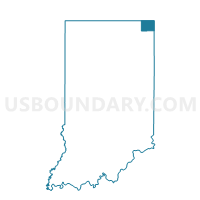
Outline

Summary
| Unique Area Identifier | 580667 |
| Name | YORK |
| County | Steuben County |
| State | Indiana |
| Area (square miles) | 22.19 |
| Land Area (square miles) | 22.19 |
| Water Area (square miles) | 0.00 |
| % of Land Area | 100.00 |
| % of Water Area | 0.00 |
| Latitude of the Internal Point | 41.65908060 |
| Longtitude of the Internal Point | -84.84181580 |
Maps


Graphs
Select a template below for downloading or customizing gragh for YORK, Steuben County, Indiana


Neighbors
Neighoring Voting District (by Name) Neighboring Voting District on the Map
- Voting District 0591278000001, Hillsdale County, MI
- CLEAR LAKE, Steuben County, IN
- FREMONT, Steuben County, IN
- OSTEGO, Steuben County, IN
- PRECINCT FLORENCE, Williams County, OH
- PRECINCT NORTHWEST, Williams County, OH
- RICHLAND, Steuben County, IN
- SCOTT, Steuben County, IN
Top 10 Neighboring County Subdivision (by Population) Neighboring County Subdivision on the Map
- Fremont township, Steuben County, IN (2,993)
- Otsego township, Steuben County, IN (2,575)
- Camden township, Hillsdale County, MI (2,047)
- Florence township, Williams County, OH (2,026)
- Northwest township, Williams County, OH (1,236)
- Scott township, Steuben County, IN (1,111)
- Clear Lake township, Steuben County, IN (799)
- York township, Steuben County, IN (733)
- Richland township, Steuben County, IN (570)
Top 10 Neighboring Unified School District (by Population) Neighboring Unified School District on the Map
- Steuben County Metropolitan School District, IN (18,053)
- Fremont Community Schools, IN (7,041)
- Hamilton Community Schools, IN (4,327)
- Camden-Frontier School District, MI (3,817)
- Edon Northwest Local School District, OH (3,372)
Top 10 Neighboring State Legislative District Lower Chamber (by Population) Neighboring State Legislative District Lower Chamber on the Map
- State House District 74, OH (118,430)
- State House District 58, MI (91,936)
- State House District 51, IN (62,592)
Top 10 Neighboring State Legislative District Upper Chamber (by Population) Neighboring State Legislative District Upper Chamber on the Map
- State Senate District 1, OH (351,303)
- State Senate District 16, MI (253,123)
- State Senate District 14, IN (139,068)
Top 10 Neighboring 111th Congressional District (by Population) Neighboring 111th Congressional District on the Map
- Congressional District 3, IN (723,633)
- Congressional District 7, MI (676,899)
- Congressional District 5, OH (627,799)
Top 10 Neighboring Census Tract (by Population) Neighboring Census Tract on the Map
- Census Tract 9502, Williams County, OH (4,082)
- Census Tract 9708, Steuben County, IN (3,762)
- Census Tract 512, Hillsdale County, MI (3,467)
- Census Tract 9712, Steuben County, IN (3,378)